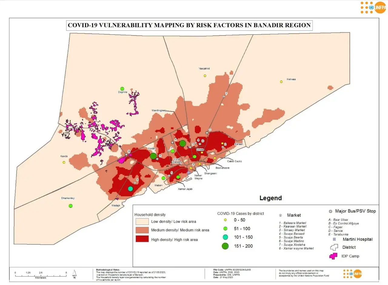
The IDP camps displayed in the map were digitized on google earth’s imagery dated March 2020. This was due to the unavailability of the latest satellite imagery to meet the urgency. The camps locations were verified with the support of the staff from the Directorate of National Statistics, Somalia. Approximately 258 clusters of IDPs were digitized with the highest concentration of the IDPs found in Dayniile and Kaxda.
COVID-19 Vulnerability Mapping by Risk Factors in Banadir Region

Publisher
Number of pages
2
Author
UNFPA Somalia
Publication
COVID-19 Vulnerability Mapping by Risk Factors in Banadir Region
Publication date
03 June 2020

